Tour Route

Tour Route

Saturday, August 16, 2014

From Sea to Shining Sea!

On Sunday night, after a fun game of Let's-Make-Dinner-From-The-Convenience-Store, we did get an edible meal on Sunday night at the Dayville Presbyterian Church. That night we ended up sharing the church with a young British couple. They were touring the states for a while, then planned to head to Mexico, hopefully allowing for a stop at Burning Man later in the year. Overall, they were a lot of fun.

Monday morning we woke up really early and rolled out of the church by 6:30 to beat the heat. We climbed slowly but surely for about 30 miles, then hit a huge descent into the little town of Mitchell for second breakfast.  The climb wound through old John Day fossil beds and painted rocks, making for a lovely scenic ride. The climb back out of Mitchell was considerably less fun. That one was 6-7% steep for a while. Though it started warming up on us, conditions could have been much worse. The road passed through a recent forest fire area, which had burned so hot part of the road had been melted and needed repaving.
The ride down the other side required some pedaling, a free ride by no means. Nearing the end, we were all getting pretty tired. At mile 83, when we were a mere two miles out of our Prineville destination, we saw a car pulled over on the side of the road flagging us down. The owner of the car introduced himself as Walt. Apparently he had hosted other cyclists at his house over the years and was offering to let us spend the night with him and his wife. Dad was quick to accept this offer, so we turned around and rode the two miles East to his house. Mom and I were a little hesitant about agreeing to stay with this guy, not knowing what to expect and being completely out of food. Once we arrived though, all of that changed.
With Walt, Pat, Manny, Moo, and Tiger
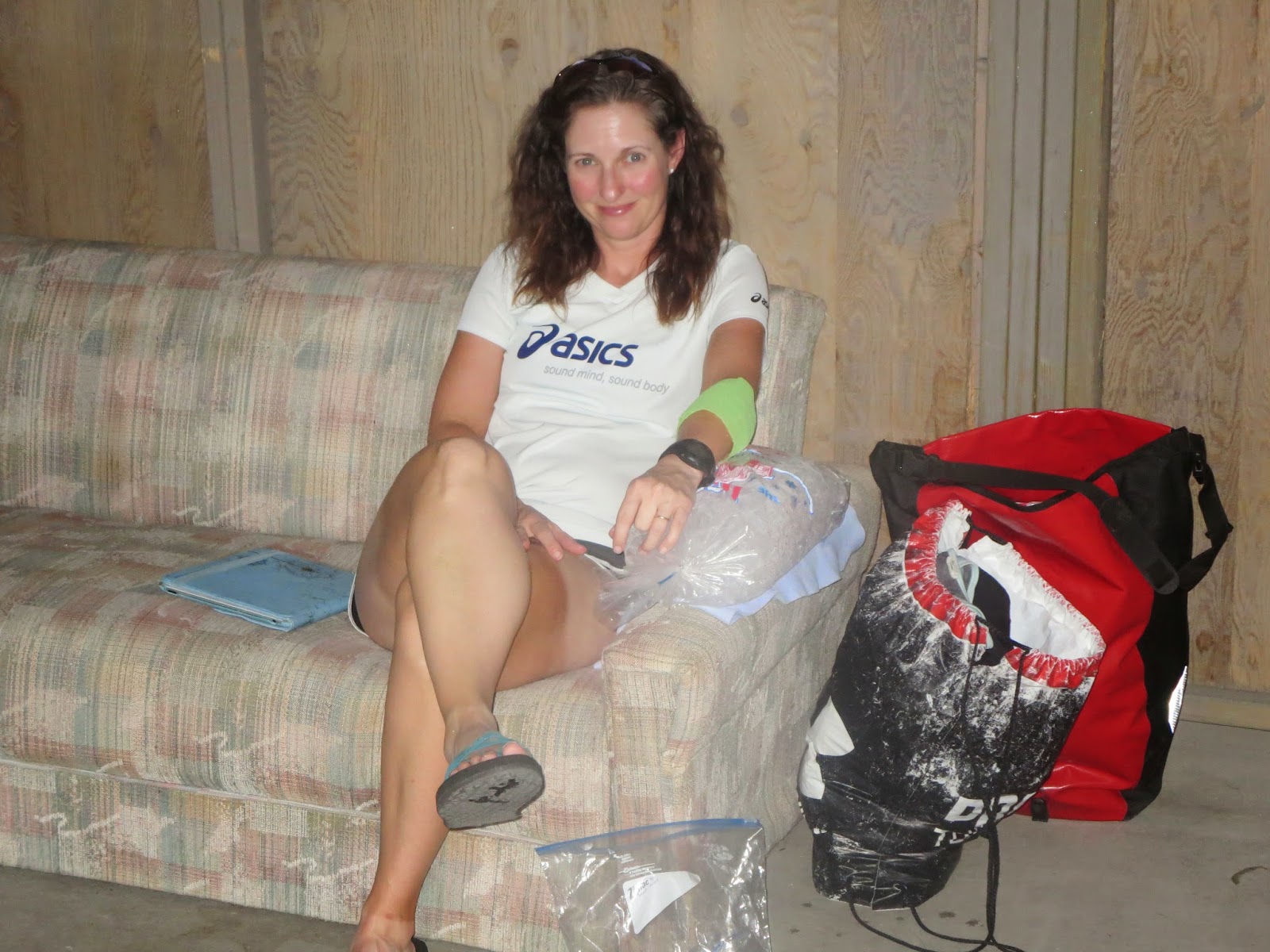
Walt and his wife Pat were a great couple, no strangers to cycle touring, nordic skiing, and scuba diving. Both were retired teachers, and Walt had taught 9th and 12th grade English classes. Convenient for Shelby and I. They were the most gracious hosts. They and their three dogs welcomed us into their home, let us sleep in their basement, and made us some delicious chicken and corn for supper. It was real food. Walt also had a fairly extensive banjo collection, and was pretty good on the guitar, so the rest of the night was full of old-timey music and song. The total for the day was 86 miles, and we slept soundly in the cold basement, away from the stormy night.

We got rained on again.
Though the morning looked clear, the radar showed some storms approaching. We got up and headed out hoping to beat the rain at least to the town of Sisters. We were only 2 miles from town when the skies opened up. By the time we made it to a restaurant, we were soaked. Just as we started attempting to dry off, a waitress came outside and told us we couldn't eat there because it was a bar and Shelby and I were minors. So we had to brave the rain one more time to find another restaurant that would put up with us. By the time we had finished eating, we were shaking from sitting in cold wet clothes, so we headed to the laundromat to dry out and warm up. During the entire time we were at the laundromat, the rain stopped and the sun came out. When we were finally finished and ready to head up McKenzie Pass, the rain started again. This time it didn't look like it would stop, so we pulled into the first hotel we saw and got a room for the night. The day ended up being only 45 miles. It rained through the night.

On top of McKenzie Pass.
On Wednesday morning when the alarm went off, Mom and Dad checked the weather and determined that rain was inevitable and climbing & descending over the Cascades in the rain would be irresponsible and dangerous. Shelby and I finally woke up on our own to realize that no one was moving and were told that it would be a rest day. It was disappointing to hear that so close to the finish line. We weren't exactly thrilled. To add some salt to the wound, it did not rain in town until evening.
The day was saved by a visit from our friend Scott Mizee from Portland. He was in Bend on business and stopped by to have lunch and catch up with us. The day wasn't completely wasted that way. He also informed us that it had been raining on top of the pass, which made the decision to stay a bit more reasonable.

Thursday we woke up to really cloudy skies and 100% humidity in Sisters. We rode up the pass, gaining about 2,000 feet of elevation. McKenzie Pass is the old back highway over the Cascade mountains, so it was virtually empty. It was also the scenic route, ending at the top with winding roads through lava fields. Typically one would have a great view of the mountains from the top, but it started raining on us at the top. We put on all of our warm clothes and prepared for a freezing descent. Our hands and toes were going numb, the road was slick with water, and the corners were tighter than we've seen all trip long. It was good that cars don't typically take McKenzie Pass, because there was no shoulder available, and the turns were so tight we were way out in the middle of the road on the way down.

McKenzie dropped us down about 4,500 feet from the top, thankfully warming up the farther we went. The road started getting loud as we rode on towards Eugene and the coast. Our day was longer than we expected, putting us at 108 miles to get to a campground on the west side of Eugene. All we could find for breakfast on the way were some convenience store peaches, so we picked those up on the way. When we arrived there, Mrs. Kuklinski, a wonderful family friend and our Boise transport, flagged us down and welcomed us in. We all went to bed pretty quick, exhausted from a long day.

Friday we hoped would be our final day of the tour. We hurried to pack and eat our peach so we could get to a town with real food as soon as possible. Bike tourists are always hungry. Apparently, my peach wasn't very good, because my stomach rejected it an hour later. Dad started getting worried that I either had the flu or food poisoning and wouldn't be able to ride. I was afraid that he would put me in the car for the last 60 miles to the coast just so he could finish the ride. Thankfully, after that one system reset, I was good to go. So we took one more bike ride for the trip.

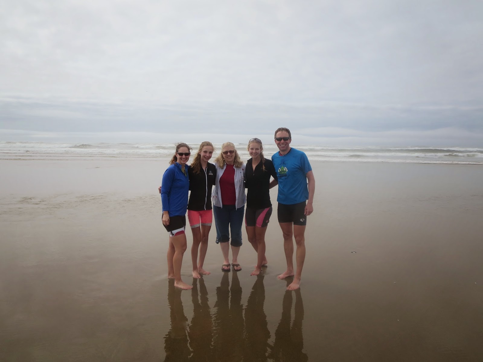
Around noon, we made it to Florence, Oregon. A truly momentous occasion. Our next order of business was to head to Mo's for some clam chowder on the coast, then to the beach for a tire dipping. The beach was more fun than we expected. It was finally real. It's fun to stand in the Pacific Ocean and tell the world that you just rode your bike there from Maine. We rode our bikes right into the water. Sea to shining sea.

We didn't get around to leaving the coast until about 3pm Pacific Time. Sadly the 9 hour drive took longer than we hoped, and we didn't get home until 4:30am. We drove almost all night and dragged Mrs. K through it, so we're all extraordinary thankful that she puts up with us. She's the definition of a great friend.

Now, we're home in Boise, safe in our own house with our dogs again. It's going to be a bit strange trying to transition back to normal life. Whether its getting back into work and school, time apart from family, or even just trying to eat less as we exercise less, it's a lot different.

If it did anything, this trip allowed us time together, uninterrupted. Even if we got on each others nerves every once in a while, being forced to be together was a good thing. We spend so much time in separate lives, especially now, that this trip was important for us. All I can say now is that I have an awesome family. We made it.

Thanks to all for following our adventure!

Love,
The Galinats

For the statistic nerds in our lives (we know you're out there), here's some info on how far we went, how many times we camped, how many times people crashed, what songs we sang, etc: Statistics

Sunday, August 10, 2014

Smoking Hot

Friday morning we tried to pack up early to get out of Hells Canyon before it got too hot. Unfortunately leaving a canyon means a whole lot of climbing, and we definitely did our fair share of it that day. It was pretty desolate country for a while. Lots of sagebrush.
With Darin and the PBR.
We were following the old Oregon Trail route for a while. I think we all agree that being on the wagon train through that stretch of country would be no fun whatsoever. The ride was difficult.
At one point we were riding along, uphill of course, when a car rolls up really slow beside us. Then we all see some lady handing a PBR to my dad. He takes it and asks, "Is it open?"
"Put it in your pocket!" comes the response from the vehicle.
"Darin! My buddy!" says dad, and we all ride up to meet the car and chat with Dad's co-worker who was traveling with his family for a vacation. It was great to see someone from home. We're finally feeling close. Later in the day, only 10 miles from Baker, we had to break out the emergency backup suckers for some sugar power the rest of the way.
Once we made it to Baker we rode to Albertsons, which was also a wonderful thing to see, which conveniently had a clinic with a PA who could take out Mom's stitches. Overall this was a pretty difficult day.

Lollipop lollipop.
Saturday we got a bit of a late start as it was so cold in the morning. We had a lot more climbing to do that day, over three different passes, one right after the other. Thankfully there was a little restaurant after the second climb to refuel at with some blackberry cobbler and ice cream. We rode 70 miles into Prairie City that day, where the air was pretty smoky from all of the forest fires nearby.

This morning was all downhill, a nice break from the climbs the past couple days. By the time we finished the 45 miles to Dayville, it was a little after noon and really starting to warm up. Ahead of us all we had to look forward to was a ton of climbing. So, we decided to take an easy day and hang out in town. We found free cyclist lodging in the local Presbyterian church. They're letting us sleep in the sanctuary and use their full kitchen, shower, and laundry, so staying here didn't take much convincing. We spent part of the afternoon playing a rousing game of Bible Trivia. Mom won.

Shelby's view.
Tomorrow we have to climb not only the giant pass we skipped today but another one just like it. Each is about 3,000 feet of elevation gain. The good news is that we are still ahead of schedule and hope to be back a day early.

Roadkill Report: Bird, Deer, Bird, Bird, Snake, Deer, Raccoon, Bird, Bird, Deer, Bird, Bird, Bird, Bambi, Bird

Money Found: $1.00

Friday, August 8, 2014

Take Me Back To Idaho

Monday was our biggest day yet. After leaving the campground at Lolo with the square dancing folks, we headed up Lolo Pass. The climb wasn't bad because we did it early in the morning. Highlights of the climb include riding right past a bull moose laying in the dirt with only one antler left, and Dad finding $5 in the bushes.
Cooling off in the Lochsa.
At the top we crossed into the best state ever, Idaho. It was also the continental divide, but the fact that we hit Idaho was probably more exciting. After crossing the pass, we had a huge descent. The first part was steep, taking us to the beautiful Lochsa Lodge. Though we considered staying there, it was only lunchtime and 43 miles into a day upon our arrival. So, we decided to continue riding, even though it would be 60+ miles to the next campground.
The good news was the ride was slightly downhill the whole way, dropping us to about 1500 feet from 5200 at the top of Lolo. It definitely warmed up as we lost elevation, but the ride wound on a beautiful road along the Lochsa River, which gave us a couple of opportunities to get in and cool off in the water.
Our total mileage for the day was a whopping 109. This was the first century ride ever for Mom, Shelby, and myself. We pulled in to Three Rivers Resort later than usual that evening.
After dinner we talked to the lady across from our campsite about our trip, answering the typical questions. As we talked, we found out that she was from Boise. Later, when her husband and 3 boys pulled up from their fishing trip, I realized she was married to my thumb therapist. Now we were really feeling close to home.

Tuesday we paid for our downhill day with a lot of uphill. Right out of Kooskia we hit a road called "Lamb's Grade" that we took to Grangeville. This road would have more appropriately been named "Lamb to the Slaughter" or even "Satan's Switchbacks". The gentle idea the word "lamb" brings to mind was entirely incorrect. For a while we were climbing at at steady 10-13% grade in worse heat than we've experienced in a while. We were thankful for the few "flat" sections of only 5%.
Dad's so concerned he takes my picture.
I must have tried to climb this hill a little too hard because after an especially steep section, I stopped and tried to catch my breath. Apparently I couldn't catch it, because after a minute, my brain went a little fuzzy and then my world went black. I woke up on the ground and in the weeds to Shelby seeming concerned and Dad taking pictures.
After my little fainting episode, none of us were willing to risk biking up the hill anymore. We were gaining elevation fast. Dad tried to ride a little more, but eventually we all gave up and pushed our bikes the rest of the way.
Once in Grangeville, we paid the Taco John's people a lot of money for food and cold drinks.
Pushing Lamb's Grade
The rest of the way up Whitebird hill was easy compared to Lamb's Grade. It was even shaded on the way up. Down was a bit frightening. Switchbacks on the old road, while free of traffic, are tight and difficult to safely maneuver on heavy bikes. Our hands hurt pretty bad from riding the brakes when we finally got to town. We stayed in an RV park right on the Salmon River that night. The water we SteriPen-ed from the river tasted better than the well water the park provided. We are happy to be back where the rivers run clear, not like the muddy ones out in the midwest. It was 70 miles that day.

Wednesday we rode to New Meadows, once again pretty uphill on a fairly busy road, which wasn't ideal. We made a pit stop at the fruit stand that sits 5 miles outside of Riggins. We bought some peaches and berries, then an entire huckleberry pie. We sat down in the back of the fruit stand and ate the whole thing for second breakfast. Best purchase
of the entire trip.
Mom used the toilet on the back of the van...
As we approached New Meadows, we thought about staying at Zim's hot springs. Calling there and a hotel in town, we realized we could head to town and sleep inside for only 5 extra dollars. Given my parents' experience at Zim's 20 years ago (something about loud neighbors playing and singing "Brown Eyed Girl" over and over until 2am...), we headed to town. It was 62 miles.

Hells Canyon.
Today we thankfully got some downhill in the morning out of New Meadows. It was heating up again today as we climbed up a 4100 ft pass, then descended into Hells Canyon. It is appropriately named. Sure is hot down here. The road had an awesome view along the Snake River through the afternoon.
We crossed the Snake into Oregon today, a truly momentous occasion. The Oregon Sign we snuck onto Mom's trailer made it the whole way as well. We're in Oxbow at an Idaho Power campground, a random oasis in the middle of this desert, 87 miles from New Meadows.Tomorrow we plan to get up early to climb out of the canyon.


Roadkill Report: Bird, Bird, Deer, Snake, Deer, Bird, Chipmunk, Bird, Bird, Bird, Deer, Raccoon, Bird, Raccoon, Deer, Bird, Bird, Bird

Money Found: $5.56

Sunday, August 3, 2014

Stitches, Stingers, and a Sag Wagon

Wednesday morning we woke up to a cold and rainy day in West Yellowstone. The fog was thick and our rain fly was soaked. So naturally we stayed in bed a while waiting for it to warm up, which it never really did, but we enjoyed sleeping in. Once we went a few miles the fog cleared and we enjoyed a great ride along the Madison River. Late in the morning we went by Earthquake Lake, formed in 1951 by an earthquake (surprise) that caused a landslide into the river. On the day of the earthquake there were lots of vacationers camping along the river, and 28 of them died from drowning or simply being crushed by falling rocks. Suffice it to say, none of us are willing to camp along the side of the Madison River anytime soon.
At the Earthquake Lake visitor center, we met Davida, a guy who had biked cross-country a few years ago and was now riding from Yellowstone up to Glacier. We rode with him the rest of the way that day, letting him get on the drafting train we had going.
Happy in the hospital.
On the road later in the day the shoulder turned into only a rumble strip. Our options were to ride on the busy road or to squeeze onto the shoulder opposite the rumble strip onto about a foot of pavement. It was a real challenge to stay straight on the smooth pavement, and all of us hit the rumble strip a few times during the day.
About 11 miles from our stopping point for the day, we were cruising right along, all of us feeling great and ready to go further once we reached Ennis at 73 miles. Moving along, I heard a pop and felt my pannier go flying off my bag and land in the road. We heard both Davida and my mother swear, then a scrape and Mom hit the ground, unable to avoid the the bag in the middle of the tiny shoulder. Right away we could tell her arm was cut enough to need stitches. Dad sent me to the side of the road to stick my thumb out for the next truck. The first one we saw hit the brakes immediately and stopped to ask if we needed to go to the hospital.
Mom on ice.
So we sent Mom and her bike with the two construction guys in their truck, planning to pick her up at the local clinic in Ennis. Dad really pushed the pace into Ennis, clearly a little panicked. Davida trailed with us all the way to the clinic on the far side of town. When we arrived, Mom was being well taken care of by the doctor and happy with some morphine in her system. Dad took us to a hotel across the street, where we booked a room while we waited for mom to be sewn back together.

With Davida at Bike Camp.
We weren't sure how Mom would feel the next morning, so we slept in again to try to get extra healing time. She said she would just follow her motto, "Suck it Up", so off we went to climb a little pass right away in the morning. Her arm didn't hurt terribly bad on the way up, but the descent into Virginia City was bumpy and apparently really painful. Mom is typically pretty tough and has a high tolerance for pain, so when we met her in town and she was in tears, we knew it must have been pretty bad. We spent some time in Virginia City, an old preserved mining town with a high tourist population. Our plans for 65 miles were cut to only 43, stopping in Twin Bridges to give Mom some more time to rest.
Twin Bridges was a nice stop. The town has invested in "Bike Camp". They have a shelter built there for cycle tourists only, complete with a toilet and shower, all free of charge.
Davida was spending the night there too, so we got to talk to him some more. It was also Mom and Dad's 21st wedding anniversary, so we had anniversary dinner out at "The Shack". They at least had good ice cream. We bought Mom a big bag of ice for her arm.

Friday we got up and kept pushing on. Mom's arm was really killing her, and the road to Dillon, MT, was bumpy to say the least. When we arrived at the Safeway in town for our traditional 10am coffee and donuts, Mom was in tears again and unable to ride any further. In a bit of a panic, we ran through the options: taking a day off, hitching a ride, putting Mom on the tandem where she could ride one handed, or calling a friend from Boise to drive her around. I do apologize to all of those that we called hoping they could drive up here with our car the 5 and a half hours from Boise. Eventually Dad got the brilliant idea of calling the local car rental, however small it was, and inquiring about one-way rentals. Turns out one-ways were allowed, but there was a two-dollar-per-mile charge to go pick it up.
Car love.
The rental was decided on, and although expensive, it saved some poor friend the inconvenience of having to rescue us in Montana. We figure it was just a test of friendship by asking for a bailout from Boise.

So, Mom drove our official sag wagon over a bunch of mountains for the next two days. With her in the car, we did 76 miles to Jackson, climbing both Beaverhead Pass and Big Hole Pass. In Jackson, we camped outside the only lodge in town. Turns out that lodge was full for a wedding taking place the following day. The lodge is home to a hot spring-fed pool, a boiling 103 degrees. The pool felt nice later in the evening, when it cooled off and started raining a bit. That night, the wedding party enjoyed live and loud music in the lodge, which was heard all the night long until 2am.


Sunday we still had the sag with us as we rode past Big Hole Battlefield, where the Nez Perce and Chief Joseph were attacked by the US army. Later in the day we climbed up Chief Joseph Pass, then had the joy of descending a few thousand feet. At the top of Chief Joseph we crossed the continental divide, but the route had us come down on the east side of the divide. So basically, we get to cross it twice. We stayed the night in Darby at a nice RV park after 76 miles. There I drove the car to the store to get ice cream. It was a great feeling to be moving without effort for once. That night, we left "the car" there. Sniff.

Right on the lip!
This morning we rode to Lolo, right at the bottom of Lolo Pass which we will get to climb tomorrow. Early on our way this morning Dad was talking up a storm. As usual. This time, however, his mouth got the better of him. A bee flew into his mouth and stung him right on the lip. We were remembering the VeggieTales song "I Love My Lips!" with "That kid named Oscar who got stung by a bee, right on the lip!". His top lip is a little swollen now.
Later we saw our friends the Johnsons out on the road driving back to Boise from their big summer trip. They stopped on the side of the road and talked to us for a while. Mom's arm still hurts a bit, so we stopped early at only 57 miles today.

With Harrison of many jobs.
We also met a guy today who is biking from Alaska to Florida. He's a filmmaker/tourguide/audience commander for The Price is Right. Interesting fella.
Now we are at an RV park that doubles as a square dance hall. We're currently sitting right next to the hall, enjoying the free snacks, and watching a bunch of elderly couples square dance. They are all really good and in really awesome costumes and having a lot of fun. It's an entertaining atmosphere.

Tuesday, July 29, 2014

One Sleep, Ten Sleep, Bad Sleep, Good Sleep


It's on wheels!
Friday we left Buffalo and immediately hit the mountains. That day, we climbed 7,000 feet, a new record from our 6,000 vertical feet days in the East. The climb was long and steady, with about 5% grades to the top. We ate “lunch” on the side of the road on the way up. We’re getting really good at having lunch while sitting on the ground. Powder River Pass was at 9,666 feet, our highest point yet. While on the Buffalo side we had some ups and down, once on the other side it was straight down at 6%. The ride into the town of Ten Sleep was a great cruise, our prettiest ride yet through the gorge. Luckily we found a little ski resort/lodge thing and had some 3:30 burgers on the way down. We were officially back in the mountains of the West, and very happy to be there.
 Once in Ten Sleep, it was roasting, but thankfully the tiny town had its own public splash pad to cool off in. Supper was really just some ice cream and pie in the town café. We did learn that the town of Ten Sleep got its name from the Native American tribes who lived in the area. The town was “ten sleeps” from Casper and ten more sleeps to Bridger. We stayed at this RV park run by a cowboy who was housing a lot of other rodeo people and a group of people with a lot of mules. The cowboy also had a small bear of a dog. Lots of fun creatures there. It was 65 miles that day.

Snacks on the side of the road.
The next day we rode to the town of Greybull, 66 miles total. We were definitely riding through the desert, seeing a bunch of cacti and painted rock. We reached our first fruit stand of the tour that day and stocked up on fresh food. Our ride was ultimately somewhat boring that day, but we stayed the night in the Antler Inn to reminisce our trip to South Dakota and stay there a few years back. The town hasn’t changed since then, in case anybody was wondering.

The next day we rode from Greybull to Cody, another boring day of desert, but we could see the mountains approaching. In Cody we had a lot of food at Taco Johns, then went on our way to an RV park about 10 more miles down the road in order to be closer to the park. It was 73 miles that day. By the time we got there, we had a huge tailwind, and some of us wanted to keep going, but like last time, Mother got her way and we stayed where we were.
That night we met a couple of other guys from Madison, WI, who were biking from there to Salt Lake City. They had just graduated from college and have been nicknamed “The Arabians” for their supposedly cooling head scarves, lack of helmets, and sandals. They continued down the road from us, so we were the only tent at the RV park that night. Or so we thought.
Grumpy with the Oreo Express back there.
At approximately 1:30AM, a big black church-camp looking van pulled up next to us and started setting up camp. More and more people kept getting out of the van and attempting to set up their huge tent. Then they turned on the air mattress inflator, which woke up our whole family if we hadn’t been awake already. The effort of this other family to talk to each other over the racket of the inflator was not what we wanted in the wee hours of the morning.
Eventually they settled down. When we woke up in the morning, we looked over to see a huge tent, people sleeping in the van, and two people sleeping outside right on the dirt. As they woke up, I counted 9 children and 2 parents. Their van read “The Oreo Express: Yellowstone or Bust! No Stops!” This Kansas family clearly underestimated how long it would take them to get to their campground. 
Filling a water bottle on the roadside.
 Monday we rode into Yellowstone National Park. A word of warning: it costs more to take 3 bikes in than it does a single car. It was slightly uphill all the way to the entrance, but really kicked up once we were inside the park. The amount of traffic through Yellowstone granted us a lot of cheers and thumbs up from drivers and motorcyclists on the way up the mountain, even though this one was much more tame than the Big Horns were. Sylvan Pass was at 8530 ft. At the top, we met a guy from Boise. Finally getting to see someone from home, even though we had no idea who they were, was a great feeling.
The park ranger people were all a bit concerned about where we would be able to camp in the park, given that July is busy season and all the campgrounds were listed as full. We were referred to Bay Bridge, a campground slightly off route, but one that had pity on us as bikers and allowed us to stay. Sadly we did not get showers that night, even after sweating up the pass.
It rained all night long in Yellowstone, keeping us in bed until 7 when it finally let up. We had to pack a wet tent.

That buffalo is too close for comfort.
This morning was cool and pleasant riding all through the park. Yellowstone kept the ride interesting, with animals and geothermal activity to view from the road just about anywhere. There are a lot of posted warning signs about staying in your car when near wildlife, but that was a luxury this trip did not afford us. Viewing the buffalo herds off in the distance was fine, but one of them planted himself right at the edge of the roadway. We get stared at by animals all the time, but being stared down by a buffalo while on a bike is the last thing I wanted to do. We were all the way out in the other lane of traffic, trying to give this guy as wide a berth as possible. It was scary stuff.

Suckers power us.
After the bison encounter (Tatanka) it was mostly downhill out to the park’s west entrance. We’re here in West Yellowstone, Montana, at the third campground we stopped at because of busy season and all. It’s already rained again tonight. Our total for the day is 61 miles. We are now officially back on the Adventure Cycling route, though now it is the Trans America. Only three states to go.

Thursday, July 24, 2014

Sad Faces, Dark Places

With Aunt Kristen, Keith, and Kane
In the Black Hills.
Sunday, in Rapid City, the plan had been to continue biking once the temperature dropped a bit in the evening and make it to Keystone. As it turns out, the temperature never decreased, and the ride to Keystone threatened too much climbing to sound like a good idea. So instead, we stayed the night in Rapid, getting to catch up with Mom's Aunt Kristen and her family who were in town. We hit Rapid during Hills Alive, a big Christian Music Festival, which this year featured the Newsboys. They closed out the weekend, so we all hiked down to the park to watch the show. It was easily the best part of the trip so far. Shelby and I made our way to the front near the stage and had a great night.

Rushmore!
The next morning we climbed and climbed and climbed some more. The Black Hills were steep like New England was, causing some bad flashbacks to the first few painful days of this trip. During a really dark moment we pulled into a tourist campground and I rolled my bike right over a $10 bill. So that helped me through.  There was a nice descent into Keystone where we stopped for lunch, then Dairy Queen dessert.
The DQ turned out to be a bad idea just half an hour later. Despite how delicious it was, stomachs started turning as we climbed the steep and hot two miles to Mount Rushmore. It would have been much easier to go around, especially since all of us have seen it at least five times. But of course, "what would a cross country bike tour be without a picture in front of Rushmore?"So, here you have it. We made it. Hooray.
After a little Rushmore visit, we were all exhausted, so we called it quits at the Palmer Gulch KOA, a gigantic town-like campground resort near the monument. We may have only done 31 miles that day, but we climbed 3600 ft at elevation in that time. That night, we went to dinner after setting up the tent. While we were there, a storm cloud passed over and sprinkled a bit, then started a full on downpour. The rain fly was, of course, not on the tent. Shelby and I sprinted the half mile through the RVs to the tent, only to cover up a contained puddle on top of all of our sleeping bags and pillows. So those all had to be dried.

Shelby got a new saddle. Here she is chucking the old one. 
Crazy Horse is back there.
Hitching a ride.
That night a major thunderstorm passed over us, so we were up at 4 with lightning strikes and pouring rain. Thankfully the ride to Newcastle, WY was mostly downhill as we left the hills and made it back to the desert. As we were leaving Custer, the sheriff pulled us over to let us know that the road to Jewel Cave was under massive construction. Unfortunately the only way around it meant adding 60 miles to our journey, so we headed for Jewel Cave anyway.
The road was in fact under construction. There wasn't really a road at all for 3 miles, so we were forced to get a ride in the pilot car. It was a bumpy ride for sure, and certainly difficult for smaller vehicles. There was no way we could have ridden it, so we were grateful for the lift with the construction lady who liked her country music and sunflower seeds. We got to Newcastle early and took naps in the hotel there because of the rude thunderstorm awakening. It stormed even more in the early evening, dropping some huge hail for a while. We were grateful to have a roof. The mileage for the day was 52.

Tailwinds make us smile.
Wednesday was a long day to Gillette, about 78 miles. Fortunately we woke up to SE winds as we headed NW. It was nothing short of a miracle. We've been waiting and waiting for a tailwind across the plains, and Wednesday was our day. We were averaging about 19mph that morning with little effort. Once we got to Gillette, Dad and I were ready to ride the tailwind to Buffalo, a full 67 miles up the road. Mother, however, disagreed, saying it was too far and that there could be thunderstorms. So we were forced to  comply with her wishes, staying in a hotel in case of storms.
In a dark place.

These storms never showed up. This morning the winds were howling out of the SW at 17 when we woke up, and only worsened as the day went on. The only thing between Gillette and Buffalo is a little rest stop where we planned to have a snack and get some more water. Turns out there was no vending or air conditioning at the rest stop, and the water was salty. We had plenty of food, and thought we had plenty of water, so we pushed on. The winds got really bad shortly after leaving. The wind out here is completely demoralizing when its in your face, making riding tedious and exhausting. For a while we were going 7mph, maybe getting up to 10 on a downhill if we were lucky. Soon we were having to stop every mile, and starting to run out of water. It was a hot day, too. The water we had left was what we filled at the rest stop, and the salty taste only left us wanting more water. We stopped at a "parking area" on the side of the road and hid under the shade of a dumpster there. We were blessed by the sight of an RV parked there. Dad rode up to it and asked for water, and the owner emerged from the RV with an entire gallon of it just for us. It was the greatest thing we had seen all day. I could have sworn there was light streaming from the heavens on that gallon. We drank the whole thing and filled up our bottles under the dumpster. Shelby and I were looking pathetic enough sitting there that when another car stopped, they offered us some Cokes and another bottle of water. It was enough to get us through to the nearest gas station with Gatorade and ice cream.

So now we're in Buffalo at the Indian Campground after 68 miles, preparing ourselves to climb over the Bighorn Mountains tomorrow. It's dry, cooling off over night, and there's no bugs. Love it.

Roadkill Report: Gigantic Snake, Deer, Antelope, Deer, Bunny, Bunny, Snake, Deer, Bunny, Frog, Turtle, Turtle, Bird, Bird, Bird, Rabbit, Bird
Money Found: $10.02